

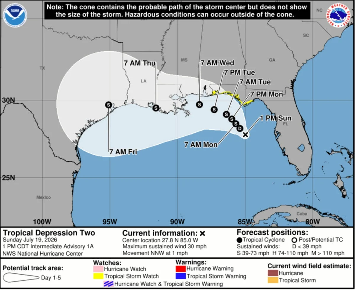
As the 2026 Atlantic hurricane season progresses, maritime and coastal authorities are bracing for the season’s second named system. Tropical Depression Two, currently churning in the northeastern Gulf of Mexico, has prompted meteorologists and cruise industry experts to issue early warnings. While the storm’s initial movement is lethargic, its projected trajectory toward the Florida Panhandle and eventual westward shift toward the Texas coast has placed major cruise hubs—including New Orleans and Galveston—on high alert.
The Meteorological Situation: Current Status and Trajectory
On Sunday, July 19, 2026, the National Hurricane Center (NHC) officially designated the system as Tropical Depression Two. As of the 2 p.m. advisory, the system was located approximately 155 miles west of Port Tampa Bay. Moving at a crawl—just one mile per hour in a north-northwest direction—the storm’s slow pace is a double-edged sword. While it allows coastal residents more time to prepare, the sustained time over warm Gulf waters provides ample opportunity for the system to consolidate its structure.
Development Forecast
Meteorologists expect the depression to reach tropical storm status—earning the name "Bertha"—by late Sunday night or early Monday morning. According to the NHC, the system currently exhibits a "sprawling nature," which, combined with pockets of dry air and northeasterly vertical wind shear, is expected to stifle rapid intensification in the immediate term.
However, the outlook changes as the storm approaches the Florida Panhandle. The NHC noted, "The system is expected to become a tropical storm as it approaches the Florida Panhandle during the next day or two. There seems to be a better opportunity for the system to strengthen once it turns westward, however, the amount of strengthening will be dependent on how far offshore the circulation is."
Chronology of a Developing Storm
The development of Tropical Depression Two follows a period of relative calm in the Gulf, but the transition to a potential tropical storm is moving through a structured timeline:
- Sunday, July 19: The NHC issues the first advisory. Maximum sustained winds are recorded at 30 mph with higher gusts. A tropical storm watch is established for the Florida Panhandle, covering the stretch from the Alabama state line to areas south of Tallahassee.
- Monday, July 20 – Tuesday, July 21: The system is forecast to maintain its slow crawl, gradually gaining strength as it nears the coast. Cruise lines begin internal reviews of itineraries for ships departing from New Orleans and Galveston.
- Wednesday, July 22: The projected path brings the center of the storm to its closest proximity to New Orleans. While no ships are currently scheduled to be in the Big Easy on this date, monitoring of the storm’s outer bands remains a priority.
- Friday, July 24: The system is expected to exert significant influence on the Texas coast. Ports in Galveston will be under intense scrutiny as the storm moves further west.
- Saturday, July 25: A critical day for the cruise industry. Three major vessels—Carnival Jubilee, Carnival Dream, and Royal Caribbean’s Mariner of the Seas—are scheduled for arrivals and departures in Galveston.
Implications for the Cruise Industry
For the cruise industry, the "hurricane season" is not merely a weather phenomenon; it is an operational challenge that requires constant coordination between meteorologists, port authorities, and captains. The potential impact of Tropical Depression Two spans several major homeports, with varying degrees of risk based on the storm’s eventual track and intensity.
The New Orleans Corridor
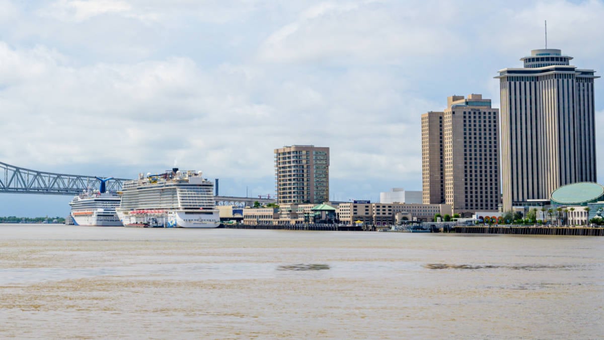
The Port of New Orleans, a vital gateway for Western Caribbean itineraries, is currently in the potential path of the storm’s remnants. Carnival Valor is set to depart on Monday, July 20, for a 5-night cruise to Cozumel and Progreso. While experts suggest this departure is likely to proceed, the vessel will likely navigate well south of the system’s primary circulation. Carnival Cruise Line has not yet issued a formal itinerary change, but guests are advised to maintain communication with the cruise line’s guest services portal for real-time updates.
The Galveston Outlook
The situation in Galveston is more complex. Because the storm is projected to move westward toward the Texas coast, the timing of the storm’s arrival coincides with the turnaround schedules for multiple ships.
Carnival Breeze is slated to depart on Thursday, July 23. Depending on the speed of the storm, the ship may face delayed departures or modified port calls to ensure passenger safety and comfort. However, the most significant logistical hurdle is Saturday, July 25. With three massive cruise ships—Carnival Jubilee, Carnival Dream, and Mariner of the Seas—scheduled to be in port, any closure or restriction of the Galveston ship channel would cause a cascade of operational delays.
If the port sustains damage or if the storm surge renders the channel unsafe for navigation, the cruise lines will be forced to implement contingency plans. These often include:
- Reversing Itineraries: Changing the order of ports to avoid the storm’s path.
- Extended Sea Days: Keeping passengers at sea until the weather clears.
- Port Substitutions: Replacing damaged or storm-prone ports with safer alternatives in the Eastern Caribbean or Central America.
Official Responses and Safety Protocols
Cruise lines are inherently resilient to tropical weather, thanks to decades of experience and sophisticated onboard weather-tracking technology. When a system like Tropical Depression Two forms, the standard protocol involves several layers of safety:
- Data Integration: Cruise lines subscribe to professional meteorological services that provide higher-resolution data than public forecasts.
- Bridge Coordination: The Captain of each vessel holds the final authority. Decisions are made based on the ship’s specific capabilities, the projected track, and the comfort of the passengers.
- Communication: Cruise lines emphasize transparency. Guests are notified via email, SMS, and onboard announcements as soon as a potential itinerary change is identified.
"Cruising during hurricane season is a reality for the industry," notes industry analyst Marcus Thorne. "Ships are essentially floating cities that can move. The danger is not the ship getting caught in the storm—it is the port infrastructure being compromised. As long as the ports remain open and the channels are clear, the cruise industry continues to function with remarkable efficiency."
Assessing the Risks: What Passengers Should Know
For travelers with upcoming departures, the unpredictability of a storm like Tropical Depression Two can be stressful. However, there are established guidelines for managing these situations:
- Stay Informed: Monitor the NHC website for official storm tracks and check the cruise line’s "Guest Advisory" page daily.
- Travel Insurance: Ensure you have comprehensive travel insurance that includes trip cancellation and interruption coverage, specifically mentioning weather-related events.
- Flexible Expectations: If your ship changes course, remember that these decisions are made with the safety of the vessel, crew, and guests as the absolute priority. Often, ships may find clearer, calmer waters in different regions, even if it means missing a planned port of call.
Conclusion: A Watching Brief
As of late Sunday, Tropical Depression Two remains a slow-moving, developing system. While it currently lacks the high wind speeds of a major hurricane, its potential to drop heavy rainfall and create hazardous sea conditions is enough to trigger a high state of vigilance across the Gulf Coast.
The next 48 to 72 hours will be decisive. If the system fails to organize, the impact on cruise operations may be minimal, likely limited to minor course adjustments to avoid choppy seas. If the storm gains strength rapidly upon turning west, however, the ports of Galveston and potentially New Orleans could see significant operational disruptions.
Passengers scheduled to sail from these ports are urged to remain patient. Cruise lines are monitoring the situation hour-by-hour, and they possess the expertise to navigate these challenges safely. As with all things in the Atlantic hurricane season, the best approach is a combination of preparedness, flexibility, and reliance on the expertise of those managing the storm’s path.
For now, the focus remains on the Florida Panhandle and the subsequent westward trek that will determine the final fate of what is likely to become Tropical Storm Bertha. Coastal residents and travelers alike should prepare for potential flooding and stay tuned to local emergency management channels as the situation evolves.
 Asep Darmawan
  Pevita Pearce
  Asro
Asro 